Every great angler has a first mate.
Now you do too.
FishPilot studies your entire fishing history: tides, weather, moon, seasons, and every catch you’ve ever logged. Upload your past photos, ask anything, and get real guidance built to help you catch more fish.
 ASK FINN
cross-referencing 47 catches…
ASK FINN
cross-referencing 47 catches…
“Most fishing apps are just Instagram with a map.
FishPilot is built to make you better.”
You can scroll social media to look at fish. Your fishing app should help you catch them.
Google can identify a fish. It can’t tell you if you can keep it — or why you caught it in the first place.
Built for the Water.
Powered by Your History.
Batch-upload years of catches. FishPilot extracts location, weather, tide, moon, and more from every photo.
Your first mate studies your patterns and surfaces insights you’d never see on your own.
Ask anything. Plan better trips. Get instant ID + keep/release guidance based on where you’re standing.
Everything You Need on the Water
Instant ID + Keep/Release
“Know your catch and the rules in one shot.” Your 22″ Red Snapper exceeds the 16″ minimum for Gulf federal waters.
Location-Aware Regulations
“Rules that match where you’re actually fishing.” Tampa Bay, FL · Gulf state waters — state vs federal, detected by GPS.
Chat With Your History
“Based on your last 47 catches, you catch more snook on falling tides after 4 PM. Thursday looks ideal.”
Bite Forecasts
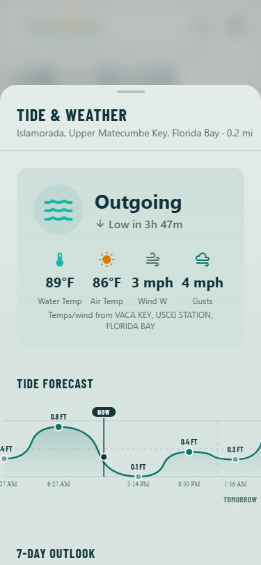
AI-powered bite forecasts that learn from your history and local conditions — scored 0–100 with your best windows.
Hot Spots & Depth Maps
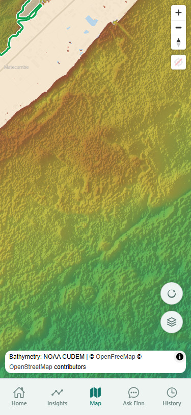
Where the fish are biting near you — over NOAA bathymetry with habitat zones, edges, and contours.
Batch Import
Years of catches, imported in minutes. FishPilot extracts conditions from every photo — your history starts on day one.
Your First Mate Keeps Watch
From emergency regulation changes to weather and marine alerts, FishPilot warns you when something could affect your day on the water.
One state. Every detail.
FishPilot is built exclusively for Florida — state vs federal water boundaries, special zones like Tampa Bay and Biscayne, FWC and federal rules, and depth maps of your flats, wrecks, and channels. We’d rather be dialed in for Florida than average everywhere else.